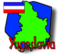
Official Name: Serbia and Montenegro (Srbija-Crna Gora, self-proclaimed former Federal Republic of Yugoslavia))
Location: Montenegro, the region of Yugoslavia that BikeAbout will be travelling through, is located on the Balkan Peninsula of Southeastern Europe (about the 45th parallel, North). It is part of one of the republics that gained independence from Yugoslavia in the early 90s. It borders the Adriatic to the southwest. Yugoslavia, which is comprised of Montenegro and neighboring Serbia, touches Bosnia and Croatia to the west, Hungary to the north, Romania and Bulgaria to the east, and Macedonia and Albania to the south.
Land Area: 102,136 sq km (39,424 sq mi), of which 13,724 sq km (5,297 sq mi) constitute Montenegro.
Coast: 199 km (124 mi) of coastline on the Adriatic, all of it in Montenegro.
Climate: The Montenegran coastal regions visited by BikeAbout on their journey through Yugoslavia have a Mediterranean climate: mild, wet winters and hot, dry summers.
Population: Almost 11 million inhabitants (about 680,000 in Montenegro), of which about 21% are younger than 15, and about 65% are between 15 and 64 years old. As of the 2000 statistics, Montenegro's population was growing much faster than that of Serbia.
Language: Serbian is the most widely spoken language, though German and French are also spoken in some groups. Albanian is spoken by ethnic Albanians in Kosovo.
Religion: Most of the population is Orthodox, especially the Serbs and Montenegrins. There is a significant Muslim minority, comprised primarily of ethnic Albanians. Roman Catholics (mostly Hungarians) and Protestants make up most of the rest of the population.
Government: The former Yugoslav republic's structure was complex: with parallel government structures for each republic (Serbia and Montenegro). The Executive Branch consists of a president, prime minister, and the Federal Executive Council; the Legislative Branch consists of the Federal Assembly (Savezna Skupstina), which is divided into the 40-member Chamber of Republics (Vece Republika) and 138-member Chamber of Citizens (Vece Gradjana); and the Judicial Branch consists of the Federal Court (Savezni Sud) and the Constitutional Court. The president is elected by the Federal Assembly, and the prime minister is nominated by the president. The judges on the Constitutional and Federal Courts are appointed by the Federal Assembly. Seats in the Chamber of Republics are divided equally between Serbian and Montenegrin representatives and filled based on party representation in the assemblies for each republic. The Chamber of Citizens has 108 seats reserved for representatives of Serbia, the rest for representatives of Montenegro. A portion of each republics representatives are popularly elected, with the rest elected based on proportional representation.
Today, the republic's unicameral Parliament of 126 seats (91 for Serbs and 35 for Montenegrins) is filled by nominees of the two state parliaments for the first two years, after which the president will call for public elections (to be held in 2005).
Executive (President or King): President Svetozar Marovic; Prime Minister Dragisa Pesic
Capital: Serbia: Belgrade (Beograd); Montenegro: Podgorica
Flag (Montenegro): ![]()
Currency: The Yugoslav currency is the Yugoslav novi dinar (YD), divided into 100 paras. There are 5, 10 and 20 dinar notes, as well as 5, 10 and 50 para and 1 novi dinar coins. The exchange rate was approximately 4.9 Yugoslav novi dinar (YD) for every $1 in September of 1996 (about the time of the BikeAbout journey). Due to high inflation in Yugoslavia, the dinar has been devalued from time to time since the breakup of the former Yugoslavia. In Montenegro, the German Deutsche Mark (DM) is legal tender as well.
Resources and Industry: Under socialism, Yugoslavia became a highly industrialized nation, with much of its state-controlled economy centered of manufacturing, mining, electronics, chemical production, and metals. These continue to be the focus of Yugoslavian production, although some agricultural products are exported. The Yugoslavian economy has been in crisis since the late 80s.
Transport: 48,603 km (30,182 mi) of road; 4,095 km (2,543 mi) of train tracks. Military action during the Kosovo conflict damaged much of the transportation infrastructure of Bosnia, but there is a rapid reconstruction effort underway.
Electric current: 220 volts.
Time Zone: GMT +1 hour
Sources: CIA World Factbook 2000, Mediterranean Europe on a shoestring (Lonely Planet), Lonely Planet
Note: The opinions expressed in these sites do not necessarily reflect the opinions of BikeAbout. If you have seen a Web site that you think BikeAbout participants would be interested in, please send the URL to links@bikeabout.org. We'll review the site and consider adding it to our resource library.
 |
 |
 |
 |
 |
|
Itinerary/ Journal |
Discussions |
Resource Library |
eDscape Projects |
Scrapbook |
|
|
|
|
|
|
Copyright 2001-2004 BikeAbout. All rights reserved.